Location: Zambezi National Park
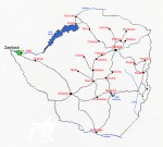
Photo: Bart Wursten
Map showing location of Zambezi National Park
General Information
Quarter degree square: 1725D3 and 1725D4 Country: Zimbabwe Habitat: Dry open and closed woodland types on kalahari sand and basalt rock; riverine vegetation along seasonal and permanent rivers; grassland vleis and rocky outcrops on basalt Altitude range: 850 - 950m Annual rainfall: c. 520 mm Location (short): Location (detailed): This park, together with Victoria Falls National Park covers a total area of about 56,000 ha in Hwange district, Matabeleland North, bordering on the Zambezi River in the North. The park is managed by the Zimbabwean Department of National Parks and Wildlife Management. |
Description
Useful links
View a list of records for Zambezi National Park
View a list of unique taxa (excluding cultivated plants) for Zambezi National Park
View a list of unique taxa (all taxa whether cultivated or not) for Zambezi National Park