- Home
- List of families
Family page - Images by family utility
Flora of Mozambique: Utilities: All images of Zingiberaceae
Images for each species
The purpose of this page is to display all images (whether of herbarium specimens or of living plants) for each species within a particular family.
Note that all images are shown, including any that are 'hidden' and any on any other of our websites.
Separate pages exist which display images of living plants only and of herbarium specimens only for this family.
Aframomum albiflorum N,Z,MS 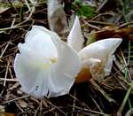
Photo: Bart Wursten
Aberfoyle Tea Estate, Honde Valley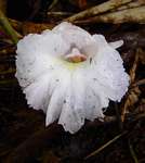
Photo: Bart Wursten
Aberfoyle Tea Estate, Honde Valley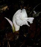
Photo: Bart Wursten
Murombodzi Falls, lower slopes Mt Gorongosa
Photo: Bart Wursten
Road from Swynnerton Memorial to main road, Chirinda Forest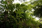
Photo: Bart Wursten
Road from Swynnerton Memorial to main road, Chirinda Forest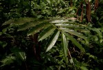
Photo: Bart Wursten
Road from Swynnerton Memorial to main road, Chirinda Forest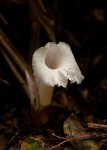
Photo: Bart Wursten
Road from Swynnerton Memorial to main road, Chirinda Forest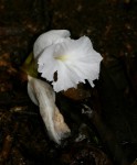
Photo: Bart Wursten
Norseland, Vumba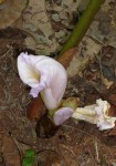
Photo: Neil Crouch
Chirinda Forest
Photo: Neil Crouch
Makurupini forest, Chimanimani
Photo: David Gwynne-Evans
Northeastern slopes Mt Mabu
Photo: David Gwynne-Evans
Northeastern slopes Mt Mabu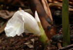
Photo: David Gwynne-Evans
Northeastern slopes Mt Mabu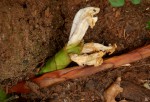
Photo: Bart Wursten
Slopes of Mt Shangani, Mandzundzu, Chimanimani Conservation Area.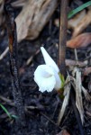
Photo: Bart Wursten
Plateau above Mevumodzi Gorge, eastern Chimanimani Mts.Aframomum alboviolaceum N,Z,MS 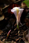
Photo: Bart Wursten
Near Yafira Village, Lomami River, Oriental, DR Congo.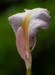
Photo: Bart Wursten
Near Yafira Village, Lomami River, Oriental, DR Congo.Aframomum angustifolium N,Z,MS,M 
Photo: Bart Wursten
Chirinda Forest
Photo: Bart Wursten
Chirinda Forest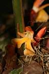
Photo: Bart Wursten
Chirinda Forest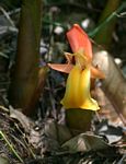
Photo: Bart Wursten
Forest on path up to plateau, Mt Gorongosa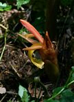
Photo: Bart Wursten
Forest on path up to plateau, Mt Gorongosa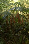
Photo: David Gwynne-Evans
Lower Northeastern slopes Mt Mabu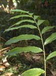
Photo: David Gwynne-Evans
Lower Northeastern slopes Mt Mabu
Photo: David Gwynne-Evans
Lower Northeastern slopes Mt Mabu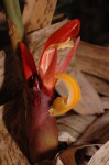
Photo: David Gwynne-Evans
Lower Northeastern slopes Mt Mabu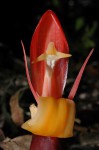
Photo: David Gwynne-Evans
Lower Northeastern slopes Mt MabuSiphonochilus aethiopicus N,Z,T,MS 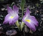
Photo: Darrel Plowes
Base of the Burma Valley Pass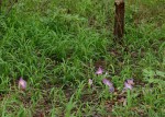
Photo: Bart Wursten
Cascades road to Morumbodzi Falls, lower slopes Mt Gorongosa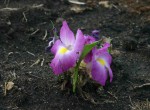
Photo: Bart Wursten
Cascades road to Morumbodzi Falls, lower slopes Mt Gorongosa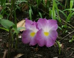
Photo: Bart Wursten
Cascades road to Morumbodzi Falls, lower slopes Mt Gorongosa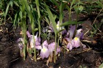
Photo: David Gwynne-Evans
Eastern lower slopes below Mt Mabu.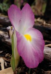
Photo: David Gwynne-Evans
Eastern lower slopes below Mt Mabu.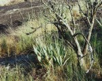
Photo: Mike Bingham
Mpika district, Mutinondo Wilderness.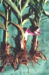
Photo: Mike Bingham
Lusaka Province, Luano Valley, Shikabeta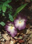
Photo: Mike Bingham
Mpika district, South Luangwa National Park, road to Kasweka.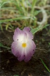
Photo: Mike Bingham
South Luangwa National Park, Nchendeni Hills.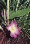
Photo: Mike Bingham
Lusaka Province, Luano Valley, Shikabeta.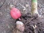
Photo: Alison Young
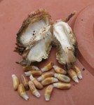
Photo: Alison Young
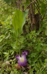
Photo: Bart Wursten
By road to Mutawatawa on other side of Mazowe River from Hippo Pools, Maramba CL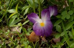
Photo: Bart Wursten
By road to Mutawatawa on other side of Mazowe River from Hippo Pools, Maramba CL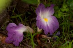
Photo: Bart Wursten
By road to Mutawatawa on other side of Mazowe River from Hippo Pools, Maramba CL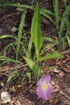
Photo: Bart Wursten
Between Bunga Camp, Gorongosa National Park and EN1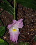
Photo: Bart Wursten
Chironde area, Coutada 12, Cheringoma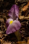
Photo: Bart Wursten
Nhahomba area, Chimanimani National Reserve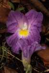
Photo: Bart Wursten
Civetta Ranger Camp, Gorongosa National ParkSiphonochilus brachystemon N No images found Siphonochilus kilimanensis Z,MS 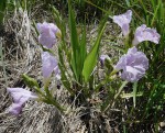
Photo: Ton Rulkens
Mopeia District, Zambezia province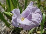
Photo: Ton Rulkens
Mopeia District, Zambezia province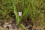
Photo: Bart Wursten
Path from Nhago Camp to nearby settlement, Coutada 12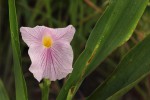
Photo: Bart Wursten
Path from Nhago Camp to nearby settlement, Coutada 12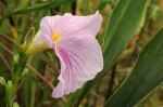
Photo: Bart Wursten
Path from Nhago Camp to nearby settlement, Coutada 12Siphonochilus kirkii N,Z,T,MS 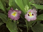
Photo: Darrel Plowes
Hwange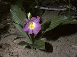
Photo: Darrel Plowes
Hwange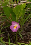
Photo: Bart Wursten
Kopje Tops, Mavhuradonha Wilderness Area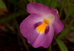
Photo: Bart Wursten
Kopje Tops, Mavhuradonha Wilderness Area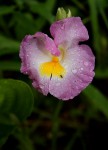
Photo: Bart Wursten
Kariba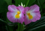
Photo: Bart Wursten
Road from Main Road to Vundu Camp, Mana Pools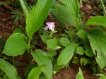
Photo: Warren McCleland
Napuda, Cabo Delgado.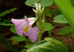
Photo: Warren McCleland
Napuda, Cabo Delgado.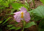
Photo: Warren McCleland
Napuda, Cabo Delgado.
Photo: Douglas Laing
Dambo near Chipata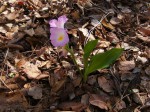
Photo: Mike Bingham
Lusaka SE 13 Km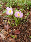
Photo: Mike Bingham
Lusaka SE 13km.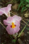
Photo: Mike Bingham
Nchendeni Hills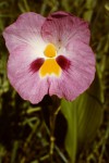
Photo: Douglas Laing
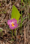
Photo: Bart Wursten
Hippo Pools, near camp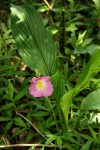
Photo: Bart Wursten
Along "inland path" Victoria Falls Ntional Park.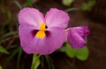
Photo: Bart Wursten
Tingwa Raphia Palm Botanical ReserveSiphonochilus kirkii - yellow-flowered form MS,GI 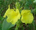
Photo: Bart Wursten
Maforga Mission, Gondola.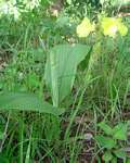
Photo: Bart Wursten
Maforga Mission, Gondola.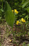
Photo: Bart Wursten
Nyamuakwarara River, John Meikle Research Station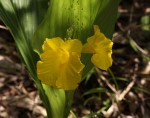
Photo: Bart Wursten
Nyamuakwarara River, John Meikle Research Station
Photo: Bart Wursten
Nyamkombe River bridge, road to Katiyo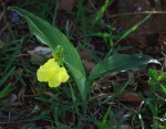
Photo: Bart Wursten
School site Nhancuco, lower slopes Mt Gorongosa.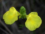
Photo: Bart Wursten
School site Nhancuco, lower slopes Mt Gorongosa.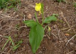
Photo: Warren McCleland
Pande, Inhassoro District.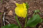
Photo: Warren McCleland
Pande, Inhassoro District.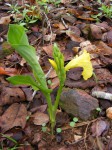
Photo: Mike Bingham
Lusaka SE 13 km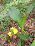
Photo: Mike Bingham
Lusaka SE 13 km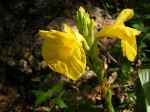
Photo: Mike Bingham
Lusaka SE 13 km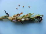
Photo: Mike Bingham
Lusaka SE 13 km.8 species found